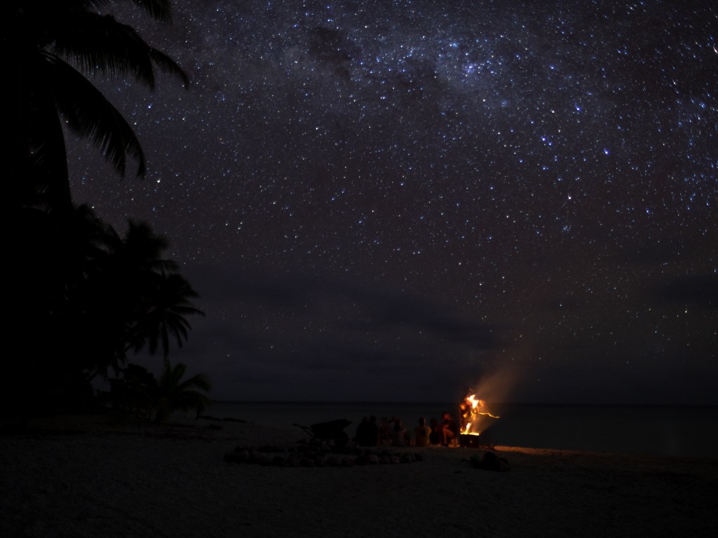
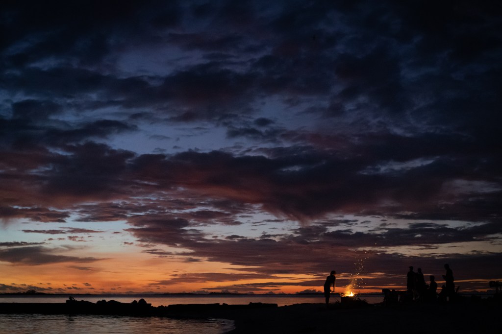
On the beach in Suwarrow: Can you spot the Southern Cross? Wayfinding, navigation without instruments, requires knowledge of star paths and positions as they rise in the east and set in the west…something the Polynesians mastered 4000 years ago as evidenced by their trek across the Pacific.Sunsets and cloud patterns give navigational clues
We headed to Suwarrow, an atoll in The Cook Islands, a National Park managed by two park rangers. The atoll has a diverse marine ecosystem, coconut crabs, and nesting sites for sea birds that populate the Pacific.
Courtesy of pngwing.com
The Cook Islands are in the centre of the Polynesian Triangle whose three points end at Hawaii, Easter Island (Rapa Nui), and New Zealand (Aotearoa). Within the triangle, there are a 1000 islands, and 1000s of years ago, seafaring Polynesians navigated from Taiwan, managing to find every island in this vast expanse of ocean. How they navigated and how they mapped these islands is only now coming to light. In 1976, folks in Hawaii built a vaka, a double-masted catamaran, and recruited Pius Piailug, aka ‘Papa Mau’, from Satawal Micronesia, a Master Navigator to guide the crew from Hawaii to Tahiti. Using wayfinding techniques, they arrived after 32 days a sea.
Book Recommendation:Sea People – The Puzzle of Polynesia by Christina Thompson is a great introduction to this amazing history–how a very long time ago, people moved from west to east, against the wind, to populate widely distributed islands of the Polynesian Triangle using navigational techniques of stars, sun, moon, waves, swells, clouds, and bird patterns. The book received various reviews and the best (though sometimes oblique) summary is here.
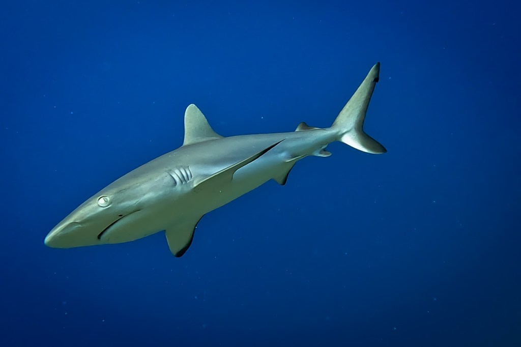
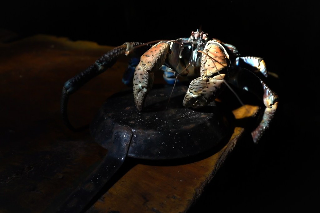
A 6′ chilled-out grey reef shark showing non-aggressive behaviour. This species will hunch its back and drop its side fins when becoming aggressive. They’ll make sweeping side-to-side motions, changing directions quickly, signalling they’re threatened and getting ready to attack. My closest encounter with agitated greys happened in Omoka pass in Tongareva: I was alone, power swimming to film a large Manta Ray when four greys quickly swam around me, dodging in and out erratically. I think they just moved in, sensing my high heart rate, checking out the action, just in case there was an easy meal to be had. Other than that single time, they don’t seem to pay us much attention, even when spearfishing.Dive on the south reef in Suwarrow lagoon, a rare (for these parts) all-black Manta RayAn adult coconut crab comes out at night to feed, and helpfully climbs into a pan for our dinner.
In case you missed it, video highlights over on youtube
Video highlights from The Cook Islands (12:38): the motto of the atoll Tongareva is “We love you so much”. We sailed off the beaten path, 200 miles northwest, to the most northern atoll of the Cooks. It is beautiful, with folks who welcomed us as family. Check out the clear waters, stunning diving, and thriving fish life. We stayed a month, made friends for life, and were very sad to leave.
The UN High Seas Treaty came into force Jan 17 2026 – we can have 30% of Oceans a marine park and have a well-regulated global fisheries. Lobby your government if they have not yet ratified it. Looking at you Canada!
Great podcast from Outside Magazine about military parajumper training in breath holding
See this story of Cook Islanders shipwrecked on Minerva Reef in 60s (film coming soon)
BBC Planet Earth: pack hunting – first documentation of snakes hunting the marine iguana in Galapagos
Book Rec’d: Christina Thompson The Sea People on ancient Polynesian Navigation (this is sooo good)


Leave a reply to sailingafrikii Cancel reply